

 Cover image via
Follow us on Instagram, TikTok, and WhatsApp for the latest stories and breaking news.
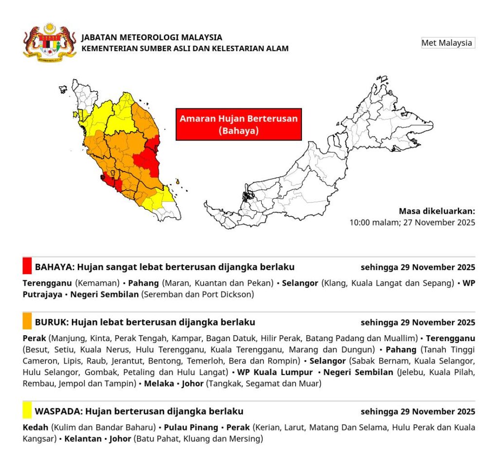
The Malaysian Meteorological Department (METMalaysia) has issued a danger-level continuous rain warning for Terengganu, Pahang, Selangor, Negeri Sembilan, and Putrajaya until Saturday, 29 November
In a statement released at 10pm yesterday, 27 November, METMalaysia said the affected areas include Terengganu (Kemaman); Pahang (Maran, Kuantan, and Pekan); Selangor (Klang, Kuala Langat, and Sepang); Negeri Sembilan (Seremban and Port Dickson); and the Federal Territory of Putrajaya.
Additional continuous rain warnings at the 'bad' and 'beware' levels were also issued across the rest of Peninsular Malaysia.
The over 24-hour rain alert comes as Tropical Storm Senyar is expected to make landfall along the west coast of Peninsular Malaysia early this morning, 28 November
According to Bernama, METMalaysia director-general Dr Mohd Hisham Mohd Anip held an emergency press conference yesterday evening, advising residents in Selangor, Perak, and Pahang to remain vigilant as the storm is expected to bring continuous heavy rain, strong winds, and rough seas from midnight until Saturday.
"Tropical Storm Senyar is expected to bring continuous rainfall over the next 24 hours, with wind speeds reaching up to 50km/h. The storm may bring around 300mm of rain when it reaches Peninsular Malaysia," he said.
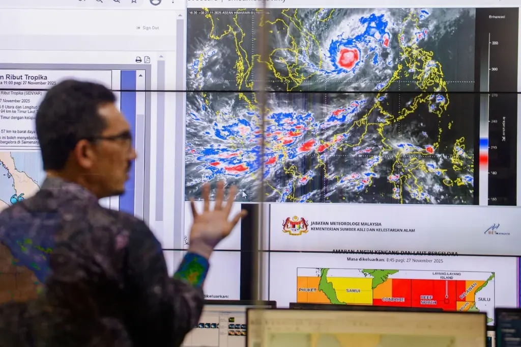
METMalaysia director-general Dr Mohd Hisham Mohd Anip held an emergency press conference over Tropical Storm Senyar yesterday evening, 27 November.
Image via Bernama/New Straits TimesSenyar is the first tropical storm ever recorded to form over the Strait of Malacca
Dr Mohd Hisham described its formation as highly unusual, given that Malaysia typically lies outside the path of tropical cyclones.
The country has only been directly hit by two tropical storms before: Tropical Storm Vamei on 26 December 2001, and Tropical Storm Greg on 26 December 1996.
He explained that Senyar occurred due to a strong typhoon forming in the South China Sea, which has influenced weather across the region.
"When a major typhoon occurs in the South China Sea, it draws in wind and moisture from surrounding areas. At the same time, there was a low-pressure system in southern Thailand.
"Both systems interacted and caused the weather to become more unstable, helping the formation of Tropical Storm Senyar in the Strait of Malacca for the first time," he said.